In this post we are taking a look at the demolition progress of Bellmawr NJ’s Browning Rd Bridge, where the core bridge structure is mostly gone.
We also review the additional progress of the adjacent Missing Moves project, which continues to move through the construction process very quickly.
This Missing Moves portion of the Bellmawr based road projects is expected to be completed the end of 2023. This is based on the initial awarding of the contract, and we see no reason to doubt that date.
Oh and the Direct Connection Wall Collapse? This week is the one year anniversary of that collapse and still there has been no final word on the full cause, the plan to correct it, and who pays for it.
In other media outlets NJDOT has said the “Fix the Wall” investigation and plan would be completed by now, and then it would go through a legal review. But we’ve heard no recent updates. That’s all I have to say on that issue in this post, but you can read my prior commentary in January here.
So keep scrolling down to see commentary and photos on the bridge demolition progress, and the fast moving updates of the Missing Moves project.
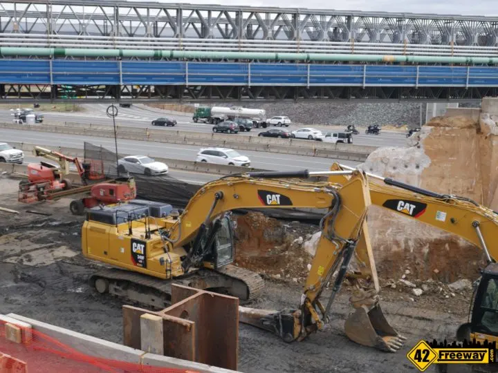
The CAT trucks cleared out all of the dirt in the open area. Gives a sense of how much more longer the new bridge will be.
Bellmawr Browning Rd Bridge Demolition
As part of the massive Direct Connection project centered in Bellmawr NJ, the Browning Road Bridge in the center of town is being demolished so that a new bridge can be built in it’s place.
After lengthy delays which were mostly related to not having enough land rights available to assemble and install a large temporary bridge ahead of construction, last summer NJDOT and their contractors were able to start the multi-phase Browning Road Bridge rebuild project.
To accommodate local traffic in Bellmawr during the reconstruction of the bridge, last summer contractors began the process to install the temporary bridge which opened in late October 2021. We posted photos and published a video of the walk over the pedestrian walkway.
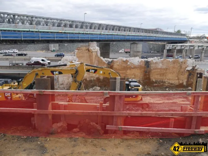
The new Browning Road bridge will be significantly larger than the old bridge.
- More than 50% longer, to accommodate the new traffic patterns below
- Wider, with wider roadway lanes for traffic
- Almost 3 feet higher, which should be barely noticed by drivers.
Several readers have asked “Why do they need a temporary bridge? Couldn’t they just shift traffic lanes over to one side and rebuild one half first, then then other?”
Well I think two things kept that from being a possibility.
First, the old bridge really wasn’t wide enough to shift traffic over, as there were minimal shoulders.
Additionally, considering the new bridge will be over 50% longer than the old it requires more ground to be dug out at each end with a new concrete support wall underneath… probably too difficult to do one slim half at a time.
While contractors did start the effort in January, there was a lot of prep work needed first before they actually started to demo the core of the bridge. They also spent significant time widening the deep cutout area on the Bellmawr Park side.
Once contractors started on the core bridge demolition, progress moved very fast. The full horizontal elements of the Browning Road bridge where it crosses the southbound side of 42/676 is completely gone, except for the thick concrete support block which held up the start of the bridge.
As mentioned the contractors also removed a significant portion of land before the start of that side of the bridge.
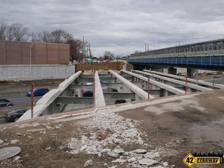
So as of today March 20th, all that remains of the full core horizontal structure are the six steel supports and columns which cross over the Northbound side of 42/676… and the matching concrete support wall for the east side.
On the cemetery side contractors will also be digging out 30 feet or more of the ground down to the 42/676 roadway depth below.
Willow Place Temporary Traffic Pattern Change
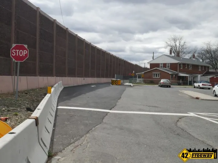
Back in October, NJDOT implemented a temporary traffic pattern change for Bellmawr Park’s Willow Place which only allows traffic in from Browning Road, but residents cannot exit back out directly to Browning Road.
This will remain in place as long as the temporary bridge is in place, and once the new Browning Road is completed, the original pattern/access will be restored.
As you enter Willow Place from Browning Road (entrance is basically across from St Joachim Church building), there is a small resident parking area soon after entering.
To exit from this area, you cannot head back to Browning Road, and instead most exit out the back through a newly installed connector road which leads to the remainder of Willow Place, and then Victory Drive near the Bellmawr Park School.
Missing Moves Photo Updates
42Freeway did a Missing Moves drone photo update two months ago, and construction has already progressed to make it worthy of a construction progress update.
Missing Moves is somewhat a part of the 295/42 Interchange in that they larger Direct Connection project does not allow 42North traffic to move to 295 South (and return the same way). Missing Moves corrects that issue by running a new $180 million roadway alongside Bellmawr’s closed landfills.
Like the last update post, we’re starting with the 42 North start of the Missing Moves project.. but at times I will face forward or backwards in down the road.
The first image below is where a new exit road will head off of 42 North.
In our prior post several readers noted that in this area (where the crane is placed and further down along 42) the ground was dug out very deep… some wondered if a tunnel was going in! Well as you can see it is now mostly leveled out and I believe that the large and deep cut out that was there before was simply foundation and drainage work to support the roadbed.
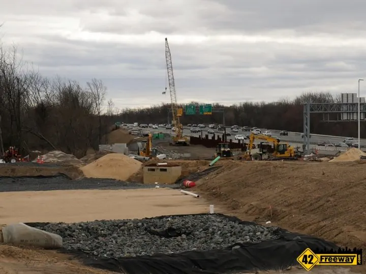
In that same image above, on the right side you see dirt starting to raise up… that is the ramp heading up leading to the bridge that will cross over Route 42.
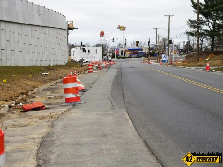
The image below shows the the top of the ramp on the left, and the new traffic light intersection that is going in here.
The traffic lights are needed here because the entrance and exit for Route 42N will be relocating here. The exit that exists today near the Sunoco will be going away. I am trying to get timing on this.
A comment before jumping over to the other side of Route 42. For the Missing Moves roadway to span across Route 42 (overhead), a support column needs to be added to the center median of Route 42. I see no signs of that portion starting yet.
So jumping way ahead now to the other side of Route 42… back behind the Curaleaf buildings on Coolidge Ave.. there are additional horizontal steel beams in place.
As a side note, Curaleaf has proven to be a very popular marijuana dispensary and they recently completed a parking lot on Coolidge Ave just past the relocated Airgas company location.
The image below shows a portion of that new parking area, and of course you can see some of the new steel in place which connects to a concrete wall support, where the road way will shift to being supported by a raised dirt hill.
For orientation, heading out to the distance (off to the right) is Creek Rd.
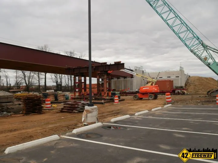
Image below is Coolidge Ave running under recently installed steel. (looking back towards Rt 42)
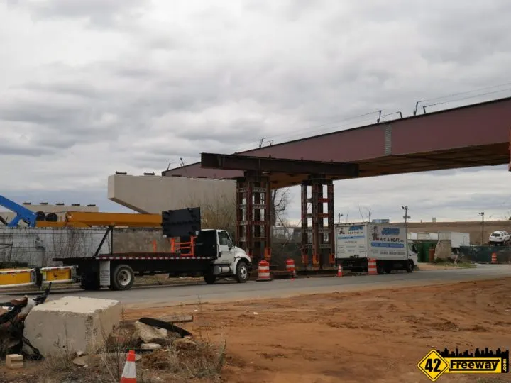
The next image is again looking forward towards Creek Road.
The Missing Moves segment from Coolidge Ave area to Creek Road will be built on raised dirt hill.
In the distance to the right that small tan/brown building is the former Lawmower Parts store on Creek Road. I am standing in the Coolidge Ave area taking this photo.
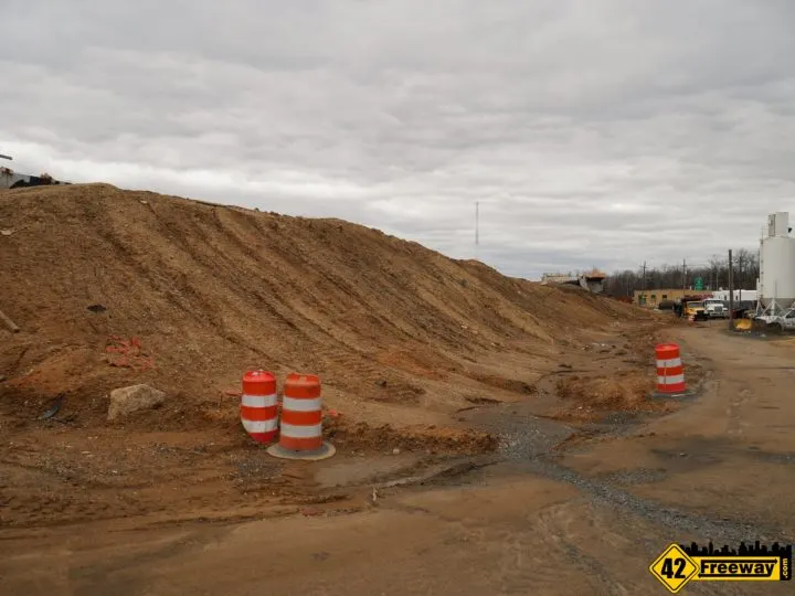
Now we jump ahead to Creek Road.
For the image below I am looking back across that dirt hill I just mentioned. In the distance you can see the newly installed steel beams in the Coolidge Ave area (which we just looked at).
This elevated dirt supported area now looks like its mostly at full height whereas 2 months ago this was significantly lower.
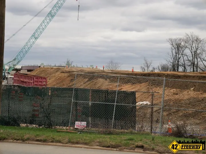
Now we are looking at where Missing Moves crosses over Creek Road.
The significant change here is they now have all the steel in place for both directions over Creek Rd, and the initially installed side which heads to 42 South has decking in place.
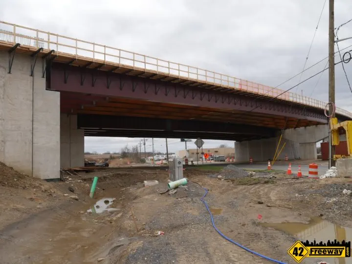
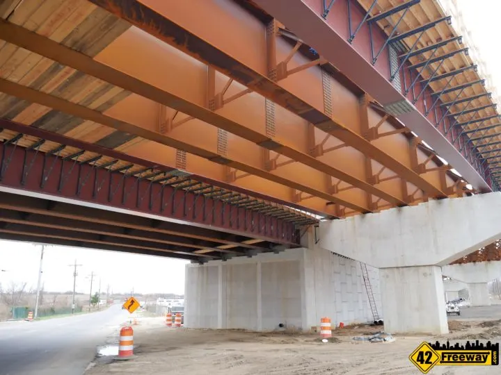
The 42 North to 295 South steel continues all the way towards 295, and crosses half of 295!
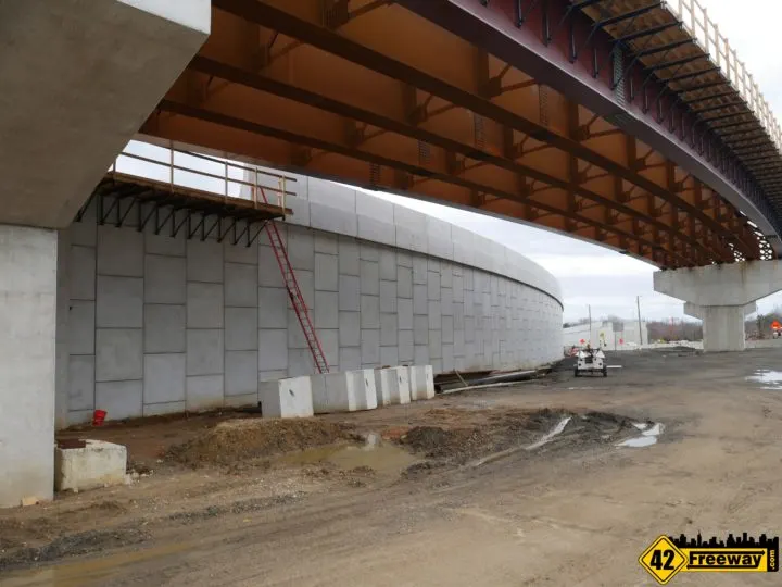
Image below is close to the edge of 295 North. In the upper right you can see the Missing Moves steel now crosses over the Northbound lanes of 295!
This photo also clearly shows how the steel and roadway will be extended over to connect with that ramp on the far side, in the center of the image.
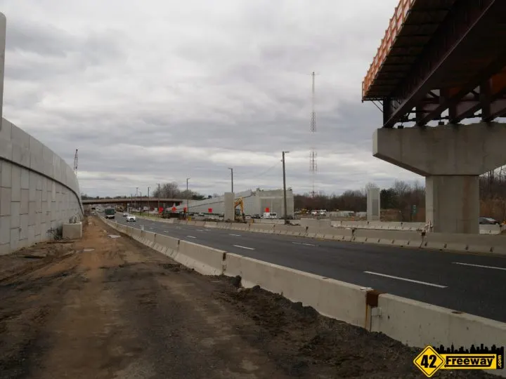
This is a HUGE amount of progress in just a few months!
Next we’re heading over to our last stop…. the new Creek Road bridge.
I thought it would be interesting to highlight the shape of the bridge, which I feel could have an impact on the final Creek Road roadway.
Below notice the Creek Road bridge profile… how the high point is not centered in the middle of the bridge and is instead way over to the right.
This is to accommodate the new down-ramp that will run underneath it.

What I am not clear on… well there are two things.
When we cross over to the other side of that new Creek Road bridge there is a small creek passing under the roadway, and also an entrance to the WIP radio tower property.
It seems that it shortens the room needed to make a less steep grade.
So I don’t expect this to be the final grade, and as they complete the final bridge construction we should see adjustments.
But in the image below the sewer grate and curbing on the far side seem permanent, so maybe that grade is permanent also?
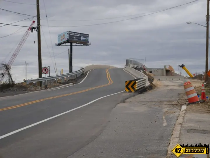
The second aspect I am wondering about is the shifted placement of the bridge.
I get that right now the roadway is significantly off-center as they work to develop the other half of the Creek Rd Bridge. Traffic is shifted over.
Today it seems the contractors have put in the core portion of the second part of the bridge… as shown in the image down below. Still a lot more work to do but the horizontal steel beams are in.
So readers on Facebook had been commenting that the current angle of the roadway over the bridge is really disjointed (as seen above) making it dangerous.
So I politely argued back that current roadway alignment was temporary while the rest of the bridge was developed.
This is still a true statement.
But now that the the second part of the Creek Rd bridge is in place… we can see that the full bridge is still significantly shifted over.
Notice in the image below we can see the old Creek Road roadway as well as the yellow center divider.
And also notice the new bridge segment has the vertical concrete wall which defines the outer edge of the bridge?
It’s about 8 feet to the short side of that old yellow divider line. A good 20 to 25 feet inside of the old bridge based on the straight Creek Rd roadway?
Well I have noticed the new bridge is at a slight angle as it heads across 295, so I assume the plan is the bridge approach here when finished will have a gentle curve to it as it connects to the original Creek Road at ground level.
Unfortunately NJDOT doesn’t really offer much online regarding the plan for this project… such as an overhead depiction of the Creek Rd bridge placement.
I’ll see what I can find out.
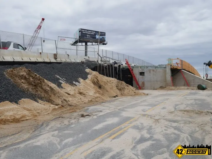
We expect they will continue a gradual curve to connect to the ground level Creek Rd.

